Transcript
Automated transcript · Written by software from the replay's audio. It can mishear names and figures; the replay is the record.
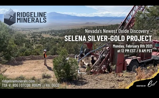
0:00 Hi everyone and welcome to Richline minerals live investment summit today hosted by 6 I'm pleased to introduce our speakers for today. We have President and CEO Chad Peters and Vice President of Exploration Mike Harp. They will be walking us through a company presentation and then we'll be going through a live Q&A. As a reminder, you can submit your questions
0:31 on the Q&A panel on the right-hand side of your screen at any point during the presentation. And as always, this webinar is being recorded and will be available on six.com afterwards. Without further ado, I'll hand it over to you, Chad. Thank you, Dasha. So we're back again after, I think it was only about 10-15 days, Mike? So we just had a great new press release today. We've announced the more than doubling of our silver-gold footprint at the Selina project, so it's a really exciting development for us. We acquired a historic database which we've been working on for almost a year and a half trying to get our hands on, but we finally were able to close that deal and we're really excited about what we're seeing coming out of it. So Mike and I are going to walk you through that today. We actually got our verify model recently updated here so we can actually kind of show you what's going on in real time. I am having a little bit of technical issues today. My internet's lagging a bit so if I get cut off Mike will take over so we'll get started.
1:27 So we got our disclaimer here obviously And we'll cut right to it. So this is a bird's eye view of the project. This is Salina, as you can see, we're only about 6 kilometers to the south of the Golden Butte Mine. Now that's owned by McEwen Mining and that's a historic open pit hosted in the same general host rocks that host our Salina discovery, right on the same structural trend. And then you look over to the north, or sorry, the northwest, and you have the Bald Mountain and the Alligator Ridge Mines. So Alligator Ridge, in our eyes, is a direct analog to what we're looking for. Hosted in the same host rocks, open pit, multiple small pits that turned into quite a substantial resource in the 1990s. So am I getting, I'm being told I have no sound in the comments, is that true, Mike? Can you hear me? I can hear you. Yes. We can hear you. Alright.
2:20 No worries. So the Bald Mountain Mine is also directly on trend up the North Carlin, or up towards the North Carlin trend. It's only about 12 kilometers away And what really gets us excited is that is an open pit mine that produces about 150,000 ounces of gold per year. And it's hosted in what would be considered an untested rock unit on our project. So we have the Alligator Ridge analog where we've proven there's mineralization And then we have the Bald Mountain analog that we're working towards, which is an untested concept in our project. And we'll show you what that looks like today.
2:55 So this is our project outline zoomed in here. As you can see, we got pretty great road access. Pretty much can drill here, I'd say what, Mike, 10 months of the year, give or take if we wanted to. Yeah, light winter pretty much all year if we wanted to. So great access. Here's what our geologic map looks like. And that's what we came in and we really came in this year early and we focused on really getting the mapping and the data collection done early. And it's led to the new discovery that we've now made. So the historic drilling that we just acquired is primarily all of these black dots. So they really just focused in the top northwest corner of the project. And they were drilling shallow. So now we know that, right? We didn't have the data. We weren't sure what they'd found in it. And we know now that they were actually drilling quite shallow holes and still hitting low-grade mineralization across the whole area. So what we did is we came in and we got collected a whole bunch of rock chips across the core of the project, soil samples. What was really, I think was a surprise to us when you say Mike is when we picked up the data and you saw how many rock chips there was. Right, yeah. Definitely doubled our rock chip database, more than doubled our rock chip database. And what we were starting to see out of those rock chips was some high grade golds and silvers.
4:09 A lot of these aren't put on, or not represented on the map via the labels, but We've seen up to 12 grams per ton at our chainman contact, which happens down at our Maximus target, which is one of our highest geochemical anomalies in both arsenic and anemone on the property. We do see some gold and silver coming up that crack as well, but We have seen at surface that these
4:32 2 elements, anemone and arsenic are directly related to our system at depth. So like Chad was saying, we focused on our mapping, really understanding our rocks and our contacts that do host gold in this area. Like Chad said, the Alligator Ridge up in the Chainman Sandstone, that's where we're seeing this 12-gram rock chip. We're also seeing the silver that comes along with it. We have high-grade rock chips at the Sonic Target where Chad had circled up north, where they had focused that historic data acquisition. We see these same high grade rocks with gold and silver at our Chinchilla target. And so what you're seeing at surface is a very consistent system that correlates to a very cohesive system at depth. So that's what we're really excited about.
5:18 When we got this data at our sonic target to the north, that saved us an entire year and a half's worth of exploration, time, money, boots on the ground, work. So getting that all at once and being able to wrap it into our data has actually given us some vectors to test this year that really focuses our drilling where these high grade targets are and should be under colluvial cover. So we do very much have some very targets out here where we can bring stack mineralization in this untested chain and unit as we go through the pilot Gilmette contact where we're seeing the high-grade discovery we had this year with the silver and gold out of our 3 phases of drilling. That's the, just highlighted in red there, that's the edge of that chainman contact. And that's kind of the knife edge where all the mineralization dips down off of, other than this little guy right here, when you say Mike, where we had those trenches. Everything else is in the valley underneath that yellow and the dark blue units, just under shallow cover. But that's almost the trap, It's kind of helped maybe potentially trap the mineralization along structural zones. But one of the things to point out about those rock chips as well is, you know, we
6:27 knew that we had decent, you know, we had quite a good rock chip spread here. We'd done our own prospecting work through here down at the Juniper target where again, you're seeing, you know, we're getting up to 6 grams gold, 260 silver, 5 grams gold, 1500 silver at surface in the exact same host rocks that hosts this discovery at our Chinchilla zone to the north. But what we didn't have was that spread of rock chips. And Mike's been what you looked through about a hundred different maps, compiling this all together and registering everything. But like
6:58 what got me really excited is, You know, you look here, right there, there's a whole bunch of rock chips scattered in here that are running 100 grams silver, 300 grams silver, 0.1 to 0.5 grams gold, a couple one grammer golds in there. So you're seeing consistent gold here, I think it's 2.95, that nice red one right there. 2.95 Gold and 55 Silver. You're seeing consistent grade all the way along these fault zones, wherever you see these faults outcropping at surface. We knew this system. We felt the system was big. I think what the historic data has now shown us is it's really given us a roadmap for where we're going in 2021. We know that the drilling intersected low-grade mineralisation, but they didn't drill deep enough. We know that there's over 2km of continuous rock chips that are running anywhere from below detection limit all the way up to 15g per tonne Gold and multi-ounce per tonne Silver.
7:51 Out of the 351 Rock chips, Mike, wasn't it about 0.22g Gold was the average grade? Right, and 8g Silver. It's extremely consistent and it matches what we're seeing in our drill holes as well, minus those high grade pops, which we're seeing at surface, but we see those in the drill holes when we hit these structural intersections between these northeasters and these west northwest faults. And when we also got out of this data, yeah, these series of faults here, what We also got out of this data, yeah, these series of faults here. What we also got out of this data in the drilling is a look at the subsurface geology and we're able to really tie this stuff together and see what was going on. Additionally, we got an IP survey, which we're interested in, but not as interested in the mag survey we just got. So this magnetic survey shows that these fault intersections are actually dyke filled. We've intersected these quartz feldspar porphyry at surface and we've also seen them crop out along structural intersections on this property as well.
8:46 And those intrusives are intrinsic to these gold silver systems in the Carlin trend, as we've seen all over the place. So the fact that we have these intrusives now and we have proof of these intrusives with this MAG survey, which we're updating now through our geophysicist, we're really starting to see that this thing has all the elements that the strong Carlin type system does have. And all of our vectoring is showing us to go southwest from the sonic, west from chinchilla, And then we have the ability to connect chinchilla sonic and even south down into our juniper and revival targets, which are along the same structural trend. And so this really is starting to have legs in showing its size, which from our last press release was a 0.7 kilometer corridor north-south is now a 2 kilometers corridor north-south with drilling and additional data to back those numbers up.
9:44 Exactly, And we should have that. This is kind of a work in progress here. We haven't been able to get our mag survey up because it just got completed, what, 2 days ago or something like that. So we're going to upload that. But yeah, I mean, we're seeing everything you want to see in a big mineralized system. This is just showing arsenic. Sorry, we were looking at Arsenic soils before. This is what our updated Silver and soils looks like. Here's that new discovery area. You can see what that looks like. That sits right in there. Turn that back off. You've got a big Arsenic Silver plume. Another one there, Another 1 there. Big guy down here. They're all tracking along these like Mike was saying at these structural intersections is where they're blowing out. Same thing with our, you know, here's our rock chips are hot there. We got great 12 gram per ton rock chip right there. What's really getting us, you know, that, that mag was kind of that last missing piece when you say Mike of kind of putting the whole story together. So where's all these where are all these fluids coming from? Well, you know, there's there's old age dating in the area that says there's Eocene age, which would be the age of the mineralization we're talking about at Salina.
10:45 Eocene age plugs and, you know, stocks and Plutons in the valley beside us. We strongly believe that these are essentially the age of mineralization and they're cropping out along these structures. We see them in drilling, we see them in trenching, but now that we have the mag, it kind of pulls everything together. You look at the gravity, here's that same model. What's interesting that we noticed is pretty much all of what carries any grade falls within these lows. We're still figuring out what that means from a, it could just be a lithologic thing with the gravity, but there's no doubt that wherever we see high-grade mineralization in drilling, typically falls within one of these low areas, right? And then our juniper target is sitting right there. Great big low sitting off the edge of it. So we're going to be using that, all this data to help target
11:41 our program heading into 2021, into the spring. And where I think it's really jumped ahead for us. As we went, for example, we had our trenches. So we did this work in early 2020. We weren't sure if this project had any legs to it or not until we did these trenches. And then it became very obvious that this thing looked like it was going to be a lot more exciting than we thought. We did trench 4, then we did trench 5, just up the hill 100m. This thing showed consistent mineralization along that structural trend along the Northeaster. Then we went in and we started doing our phase drill programs. This is what that GT shape looks like from our 2020 drilling. Now, the GT is just Mike put this together. It's just the grade, average grade, silver equivalent grade of the intercept times the thickness of the intercept. And it's a great metric for just trying to show the metal content or the total metal content of a given system. And phase 1, for example, I wasn't that impressed.
12:39 Mike came in, we drilled it, and I was like, all right, it's not bad. We were getting consistent grade, but it wasn't that thick. And Mike really pushed to keep going, heading down into the basin. You can see we started tagging in from 0 to 27m in hole number 4. From surface, we're getting 0.17g Gold and 18g Silver. That's low-grade, but it still falls into that general level. For example, the Rochester mine in Humboldt or Pershing County, Nevada here by Winnemucca, the average grade there is about 14g Gold and 0.1g Silver. That's the life of mine, head grade of that Silver open pit. So we're still in the, you know, we're still in the ballpark for sure. And then when we started stepping into our phase 2 program is when it really started getting exciting. Mike, you were on the rig at the time, Mike, you want to fill in on? Exciting was this was our first test on a West Northwest intersection with one of these Northeasters, which in all of the data seemed to point that it was all along these Northeast faults.
13:39 But in the Golden Butte area and some of these other areas, Alligator Ridge and such, it's where these Northwest faults cross these Northeasters. That's where you get these blowout zones. And so that was our first test into that kind of a target. And what we did see was that blowout in that zone, and we started to get the thicker intercepts and the higher grades where you'd expect them to be. And then yeah, there you go. And then when we got the Karatamex data, so we got this Karatamex data from a privately owned collection, a privately owned library. And so, this is the old Karatamex drilling and they were really excited about the sonic area to the north. And so we knew that's where they had focused their drilling, but looking at our drilling, we realised that we had to get deeper into this Gilmette limestone to get to that horizon that we liked. And that horizon, where it intersects these West, Northwest, Northeast faults is where we get the good blowouts of this gold mineralization.
14:37 Now, hole 22 did not properly test the Tyrant intersection. There was a planned hole to go beneath that, but hole 22 did hit the zone and show that the continuity existed down dip as we approach the Tyrant Fault, which we believe is one of the ore controlling faults in this system. And so what makes 22 also kind of a bummer was 56% sample loss. And There is a correlation to the amount of sample you get and the grade of Gold that you have. We saw this issue when I was working with Gold Standard at Pinion, when we were drilling with RC drills in these cavitated zones, the loss sample in our grade would go down. To counteract that, we would come back in and we'd drill with core. This year, this drilling programme, we are going to come in with core holes and start to twin some of these things and move this thing towards a 43-101 resource.
15:32 I see a question from Robert. Robert, we would like to get this thing close to a resource. I don't know if we'll get that many drill holes in this year. One of our main focuses is to confirm some of that historic drilling while we continue to step out along these intercepts that we got this year, but we're really going to be focused on showing the scale of this system and testing some of those open targets in these higher priority structural intersections
15:58 on the property. No, exactly, like especially with this new data that we've got. Now that we obviously have multiple kilometers of strike to this system, to try to narrow in and focus on a tight-spaced resource infill program, I think, would be premature. With what we're seeing, we think we have a significant discovery on our hands. And we want to make sure that we do the right work first to make sure that we understand what's controlling the system, where the high grades are, and try to track in on that. I mean, when Mike, you were talking about the sample loss there, it might be tough for you guys to see, but you know, through this zone, right through here, I mean, it looked great. I remember you calling me. A, we hammered into it. It's our thickest intercept yet, but we were losing too much sample. And I think you get your fine gold and silver, it gets locked up in the fractures and the clays in between these collapsed brecciated zones. And so when you come into a really well-developed collapsed brecciated and you hammer through it with RC, you end up dropping out a lot of those fines and you under-report your grades. So I'm excited to go back in this year and see what we can do about testing it.
17:06 Because of some of that sample loss, we had to combine and do composite samples for some of these intervals that I really wish we didn't have to do. That's why that core becomes very important this year. It starts to get us ready for a metallurgical inventory moving forward as things progress. That's what that core hole would look like, my terribly drawn line. Hopefully it doesn't look like that in an actual drill hole. But part of what really shows us the scale of the system is, you know, these 2 holes, they're about 600 meters apart. So we're really focused on stepping out along these, these mineralized structures and proving that we have high grades. So, you know, a lot of the work that we'll be doing is putting a drill hole right there, put a drill hole right there, kind of saying try to, that way we can infill
17:55 this shape so that it becomes one large high grade silver equivalent shape. And we'll be working on that this year. But, you know, hole 19 and 21 showed the system as just as strong 600 meters south of our, call it the discovery cross section. You know, that's what it looks like. We had 44 meters of 73.9 grams silver equivalent right at that same structural intersection that hosts hole 22, right? So same thickness of an intercept, same host rock right in the same spot, you know, night and day difference in grade. So we do feel that we can do better. Obviously the core hole has to prove it. We're not there yet, but we'll work on that this spring and like you mentioned there, Mike, that chainman limestone or chainman shale. This is an exciting target for us this year. It's shallower. You go ahead. You know the area better. Right. No. What that does for us is that gives us the possibility for stack mineralization. If the chainman is running out there, which some of the geochemical anomalies would suggest, we have the opportunity for stack zone. So bringing ore closer to surface while still having that high grade zone down in the Gilmette limestone in that what would be the target light brown area down there in the gray?
19:06 That's, what's really exciting for us. Another thing to take away from this cross section is you, you'll notice that on our, West dipping faults, we have a little bit of reverse motion. So what we've been working on and what we got from some of the old Karatamex data that's been incorporated in and from our work this year and all the geology that we got with this data acquisition, we realize that we're dealing with some reverse motion as we have right lateral shift along our northeast fault. Now all that's saying is is that we're rolling these things back up on top of themselves and so that gives you the possibility for stacked zones even within the target itself.
19:43 So that's one of the things we're going to do boots on the ground looking around this year is try to identify the magnitude of some of this thrusting as this whole range was shifting back to the Northeast. And then how that interacted with our structural blocks that we'll be targeting this year. Yeah, for sure. And this is just a picture of what that looks like. There's some good RC chips. Here's a really hot zone. I mean, you have right starting right here, 53 grams silver, 91 grams silver, 195 silver, 139,164,166,268. I mean, this is an incredible, credibly consistent zone That's averaging 0.3 to 0.5 grams per tonne gold throughout that same zone. We're really liking the continuity we're seeing and we'll show you why we think we can recreate that over at the Sonic Target. So this is now what that, obviously, that entire footprint looks like. As we mentioned, we have all of these high-grade rock chips, hundreds of PPM, grams per tonne silver, multigram gold here, here, all the way up through these guys, and then you have the sonic target up here. So we think some of the really, what really kind of cracked open the project for us is instead of having to go in ourselves and drill 20 holes to try to figure out what's going on, we can go in, use that existing data, and come in and really, I think, show that this thing can grow.
21:05 This is what this, sorry, I meant to show you guys. This is, we're gonna look at a long section because we didn't have time to put it in the model. It's cutting right from north to south, right through our known discovery, all the way up to the sonic target. Here's what that looks like. So there's the sonic target sitting up right here. And one thing, Mike, maybe you want to point out, feel free, why we think that we can come into the Juniper Sonic area and hit deeper mineralization. For sure. I'm gonna answer a question first for the core holes. We will do them partly RC if it's in an area we know that the upper portion of the hole is not carrying grade, but with the ability to have stack mineralization, If we're gonna drill a core hole it would likely be from surface at least for the first phase to make sure we're not missing any of that mineralization as we're going down. But if we have definition yeah we'll utilize the RC contract that we have put in some fairly cheap pre collars to just get us down to that zone and sell us some money, absolutely.
22:04 But if we do get some of that raised mineral or higher mineralization, say the Joanna or the Chainman, we would just core from surface to make sure we're getting it all. And I think based on the continuity we've seen in every hole but 22, I think we're pretty comfortable using a lot of RC drilling still, but we'll want to throw in little bits of core here and there just to validate the data and make sure that it's correlating well. But Chad, to continue on what you were talking about, moving from the sonic target into the chinchilla zone. You'll notice the chinchilla zone is still fairly wide open in its corners where the 2 sets of Northeast faults are coming down. So that would be our stars and our Aurum faults as they cut across the property. What I do like is the high-grade rock chip just southwest of where hole 21 hit.
22:55 And we also have a strong arsenic anemone hit over there and that's 73 grams per tonne silver with 12 grams per tonne gold with the highest geochemical anomalies in soils on the property at that location. And I just love that look on how SE2021 is aiming right towards that corner. And you'll notice there's 2 little core RC holes hanging off there right on the fault. Those are so far East. No, come over to, into the fault zone over here, Chad. Oh, these guys. Yeah. Those, those are back behind us. Those are really far East. But what you'll notice is, is that when you look at our Chinchilla target and you go over towards the, to the right side of the screen to the sonic target where we know we have some of these buried intrusives, they didn't accurately test our Gilmet limestone target. We're seeing these higher grade Golds. It's wide open as we move south into our chinchilla target, which remains open in all directions. So I'm really excited about the fact that we can come back into these under drilled areas where we're actually seeing the Joanna for the first time, our Joanna limestone unit, which is above the pilot. That would be the light blue that you see on these, on this cross section.
24:07 That is actually running for the first time on this property as we get closer to these intrusives. So that's, what's really starting to excite me is that. Now we have these engines and we have gold running in units that's not well, not that it's not supposed to, but that we haven't seen yet. And the zone that we're really starting to find at the Chinchilla area is still wide open heading that way. Yeah, that's what I'm most excited about at this point. Yeah. Yeah, no, for sure. And like, you know, you look all of these holes right here, you can see they're all running great. They did not test the target horizon, right? They're too shallow. It's all the waste, what we would call waste rock above it, is actually running low-grade gold and silver. We don't actually see that happening over at Arch and Chilla, our new discovery. We don't see the upper units typically running. So I think it speaks to the potential strength of the system.
24:54 Mike mentioned, we got this big buried intrusion that we've identified with MAG as well. So it's setting up for a pretty exciting drill program this year. And you point out the rock chip right here. That's 55 grams silver, almost 3 grams per tonne gold. There's not 1 hole in what would equate to almost a 400 metre long structural block has never had a drill hole that tested deep enough, right? You have multiple holes out through, like we mentioned, you got a 12 grammer there. There's all kinds of rock chips scattered through here that are decent grade as well. So we're seeing, I think what the historic data really did for us is it just pulled the whole story together. I mean, we had a feeling for what we were drilling, but to have that confirmation that, okay, you know, they drilled, they were, they were onto it, they just weren't drilling quite deep enough. And in the 1980s, that makes sense, right? I mean, silver was what, 3, 4 bucks?
25:46 You know, like, If you're looking for a silver deposit in $3 silver prices, this isn't gonna cut it, but we're in a different time now and we can now target this a lot more efficiently and I'm really excited for our program this spring. I think it's gonna show the same growing considerably. Agreed, and you can really see from that image that cross section the in between the 2 zones we drilled in our phase 3 where hole 21 and 22 is just the openness in between those 2 and why we're going to put those holes that Chad marked in the plan view in between that the GT shape because it looks like they would have excellent continuity running through that entire block.
26:22 And these 2 holes were drilled into the hillside or into the image. So they were actually a few hundred meters out from the strike of these guys holes here. So yeah. And this is a compilation. What you're looking at here is the compilation of the work done by our project geologist, Gabe Aliaga, fantastic geologist that put this together and identified these individual blocks that will become part of our targeting this year and these intersections of these blocks. It's because of this data and the fantastic work done by this team that we've come to these conclusions and we're excited about this next drill program. No, for sure. And so this is what, you know, so now we got, you know, we've highlighted, all right, the, you know, the historic drilling really cracked open the sonic area for us, but where can we take that next, right?
27:15 And I think what we need to go back and take a look at is our Juniper target right here. That's got those high-grade rock chips. Like I was saying, we're seeing up to, let me see here, try to pull it up for you. There we go. Yeah, 16g per tonne Gold, 400 Silver, 5g Gold, 1500 Silver. These are incredible at surface rock chips. We haven't drilled it enough. And now that we've been able to tie the whole model together for across 2km now, We're starting to understand where we missed with our drilling this year. So, oh, actually I got ahead of myself here, Mike. We're still on Sonic. So this is the cross section. Just getting excited, everybody. That's what this cross section looks like that I'm gonna show you right now. Again, we just didn't have time
28:02 to get these, but this model's been pretty fluid. You know, we've been putting data together and handing it over to verify as we go here. So here's what that cross-section looks like, and it really highlights what Mike was saying. You know, most of these drill holes, they're in the light blue in the pilot. They're still running wide intercepts of low-grade silver and gold. The only holes that really tested decently into that actual limestone contact right at surface hit 17 meters of 24.9 silver equivalent, 17 meters of 17 Silver equivalent. That's still on the lower grade end, but we've hit internal zones of lower grade in our new discovery to quickly follow it up with a great drill intercept, you know, 200m away. So, we need to come in, test along this untested target, you know, even, I mean, look, they lost some of the holes, right, Mike, like these 2 guys, they ended in 0.2 grams per tonne gold and low silver, and they were locked in a silica zone.
28:54 Yeah, in the old data, that was the most common reason these holes didn't reach target. It wasn't because they didn't know what they were doing. It was because difficult drill conditions stopped the RC rig and would not let them advance the holes. So if we can deepen the holes through this section and then start stepping out above this intrusion into the primary host rocks, we're pretty excited to see what comes out of it. And then on top of it you have the potential for stacked mineralization in the light brown, that's that chainmanshale that Mike was talking about. So we're seeing the same general geologic model hold together over 2 and a half, 2, 2 and a half kilometers now from Sonic all the way to Juniper. And when we go in and look at the Sonic, here's where I was meant to be. This is the Juniper targets. This is on the other side of the discovery. So Sonic's to the north, Juniper is half a kilometer to the south of that discovery. Here's that main discovery area. Whoops, I was not supposed to do that.
29:48 There we go. That's better. It shows a little better. Here's the new discovery right here. Sonic right there. Juniper targets down here. And we've been able to tie it all together with that historic data. So if you look at a cross section right down here across the Juniper zone, here's what that looks like. So this one's wide open. There's no drilling really other than what we did in the spring and of 2020. And here going up this hillside is where all those high-grade rock chips are. So they're right at surface, shallow bleed up along these structures. We hit wide low-grade and narrow high-grade. So we actually had our hole number 10 bottom in 3 meters of 78 grams per ton silver and gold, or silver equivalent, sorry. And what we now know too, is there's quite a bit of structural offset going on.
30:35 There's some of that, as Mike mentioned, there's some of that thrust component, which is thrusting up the pilot and was messing up this whole story right here when we were drilling. So We want to come in, get on the other side of that Orem fault and start drilling the down dip extension as well as the stacked zones. One thing to really point out here, this is that target. That's where that 12g per tonne Gold and 75g per tonne Silver sits. That's right at the Chambe and Joanna contact. We want to step out this year and drill some holes across that target as well as take them down to depth and hopefully we can
31:13 show a stack system that would really start adding a lot of tons really quickly. So did I miss anything, Mike? No, no, that area in particular, which when you're looking at this cross section, you'd be looking at the Orem fault. So it's a Northeast fault that's cutting this section that appears to be one of the bigger faults on this property for offset of these units back to the Northeast. And there's that fault system. Yeah, there it is right there. That's what makes that, what gives that one a lot of legs and possibility is we have the entire section preserved and multiple shots and bites at the same apple. Yeah. Hydra rock chips there. And then there's that 12 grammer on the same fault zone right at that. There's that chainman contact Joanna right there. That's right. Yeah. So,
31:59 yeah. I mean, it just, it really has the potential to continue to grow as we drill this whole entire property out, but the thing we like about Salina the most minus this great data acquisition that was light years of a jump for us. We're gonna be actively exploring some of these higher priority targets that we may have not gotten to because we were unsure. But as the confidence in the geologic model has increased, we would like to get out there, test those targets that have never been tested before adequately and really see what this thing has this year and move it forward into a brighter spotlight, so to speak. No, for sure. I mean, just to put in perspective, everybody, that red box that I just drew, that's our little sandbox that we've been
32:50 playing in now with the addition of the new historic data. That's what we've worked with. Look at the size of the project. We see multiple exciting anomalies here, you know, along the broken egg target, the revival target that Mike mentioned is sitting down here right along that same fault zone that cuts up through the project. I think, like we said, the important thing here is scale. To be an open pit, Mike, you've defined a few of them now in Nevada with your team, previous teams, you need to show scale first, then you start drilling it off, right? Can this thing actually get big enough to host the kind of tons you need to host an open pit mine? I think we're starting to prove that. What we're gonna do in the spring this year is really start testing some of these ideas, which now, you know, with the historic data, we can really start being very selective and target high grade zones very efficiently and hopefully show it can grow. So that's all I had to cover here. What about you, Mike?
33:43 That's about it. And then James, to answer your question, the ground to the north of us is controlled by McEwen Mining, at least what we know of. There is no active exploration in that area directly that we know of at the time. But there's been a lot of people playing in the dirt up here the last couple of years. So as far as I know, that's all we have to the North and nobody's doing anything there. Yeah, you bet. Well, why don't we, Dasha, do you wanna moderate the questions here or do you want me to?
34:19 I'm happy to do so although Mike you're doing a great job going through the questions but yeah let's just jump right into the live Q&A for the last 10 minutes here. We got some questions emailed in so I'm going to start with those. Can you provide some context on potential size for Salina?
34:38 I think we kind of, you know, we were, that's what we were trying to hit on there is this thing is really growing fast. We're seeing 2 kilometers of strike north to south, 1.2 kilometers to the east-west. I'm not going to go down the rabbit hole of starting to talk about ounces yet, but this thing is looking like it has considerable scale and you need to find something that I think if you're looking at gold equivalent, you want to always see something that shows better than a million ounces of gold equivalent potential to potentially be an open pit in Nevada. That's always a great start. And I think we're seeing that now, so. Right, and with boots on the ground walking, the corridor would be about 4 kilometers long of potential.
35:19 Yeah, multiple little satellite zones the whole way along. So, all right. Well, Mike is asking, who did you get the data from? Well, Mike, actually the contract we have from who we bought it from, we can't actually name them outright, but it's a private, like Mike said, it's a private library of someone who pretty much their background is collecting historic data and selling it to various companies. So it was a private geologist in Reno. All right. Well, so there's lots of discussion going on in the public chat. Alan has made some comments. He noted that there's a big spacing between holes and that it would be exciting to see core in there for better recovery. I was wondering if you could speak on that. He also said that I think getting core into the system is going to really blow this thing up. I hope so. I like that you said it, not me, Ellen.
36:09 But typically, in both Mike and my experience, you'll usually see anywhere from a 10% to 20% increase in grade switching from core to RC. And the reason is, is you're getting 100% of the fines out of core, whereas RC, no matter how good your RC company is, you're always breaking a little bit of that rock up as you smash it up with the RC rig, and you don't get it back. So we would be looking to, In that GT shape that Mike built, we'd be looking to selectively throw in core holes to try to bring up the average grade and continuity and then be stepping out with RC to show scale. Great. If you go into the project, the core hole will always chase the RC holes. Yeah.
36:49 Mike is asking, how well are you currently financed?
36:53 Well, we're actually in a really good position. So we have 3.5 million, probably 3.4, I guess right now, we just finished the month end. We got about 3.4 million in cash.
37:04 Like with our drilling contract, we were drilling for 15 bucks a foot in 2020, right? So we can really be aggressive this year, go out, drill a lot of holes, probably drill an easy 15 hole start to the program, and then follow up with a follow-up program later in the year if warranted. But we're in a good cash position and we can attack multiple projects with what we have in the bank.
37:24 All right, Peter says, scale, how big is big? That's a loaded question. Well, you know, I think, I think. Pardon? I would tell you, Peter, what big is to me right now is 4km strike length North to South is what looks like it could be potentially Gold bearing, silver bearing in this deposit, or in this possible deposit, right? But, and then I would give it about 3 kilometers across the property from our broken egg
37:55 on the backside, which still has a lot of potential out into the basin. And we're gonna start, yeah, we're gonna start looking
38:04 out into, into and underneath that thrusted portion of Ely limestone. And so it has the potential to really blow out and be big. And even off that 4 kilometer line that Chad drew, we still have at least a kilometer and a half of untested ground out into other contacts. So it would be quite substantial. Yeah. Like the closest comparison in Nevada would, I come back to Rochester, I sound like a broken record, but it's the largest silver open pit silver mine in the U.S. And it's a 200 million ounce open pit at about 14 grams silver and about 0.1 grams per tonne gold. So with what we're seeing, I'm not saying it's a Rochester yet, but I think we're showing enough scale that we can start advancing this thing and really see it grow.
38:53 Great, Alan asks, do you guys have an idea of the heat zone that is causing all this widespread mineralization? Yeah, I'm gonna switch to the regional view here, property view. So this is what got Mike and I kind of excited early on in the, when we picked this project up is right off the edge of this project is a, sorry, a Cretaceous, I believe it's Cretaceous, isn't it Mike? Porphyry system? Yeah, Cretaceous- About 2 kilometers of scales off there that I showed you, but about 2 kilometers this way, there's a buried porphyry system that's really deep. We believe that was the earlier heat engine for this system. And then it's the big structural, you know, everything's kind of bleeding up that big porphyry. And then we know that there's younger Eocene age or Carlin type age mineral, or intrusives that are bleeding up off that porphyry. We believe that's the actual source rock and the heat source for what is then, you're seeing mineralization bleeding up into our project along faults and structures. And I think that's evidenced too by that Meg anomaly that we're seeing now, Mike, which is sitting right, big intrusion sitting right there, right? That's right, yeah. And with this new data, our structural understanding has grown substantially.
40:06 They had a lot of thrusts mapped in their old geological work. Jasperoid maps, alteration maps were phenomenally done and they really pegged down the structures and the sense of movement We see upwards of down at the revival target almost a mile Or 2 and a half kilometers worth of right lateral shift of these rocks. So there's a going on here But they were seeing a lot of those things, these same structural traps and structural preparation that we're seeing at Chinchilla. So putting those 2 data sets together is why that cross-sectional view that Chad was showing looks the way it does now with some of the intrusives prying up those rocks as well as understanding where our shifts and our thrusts are on the property. So I would say we were really far along compared to where we started even with this data.
41:04 For sure. All right. Are you seeing any changes from fine to coarse gold and silver at depth or a long strike? That's an interesting one actually, cause we haven't, I wouldn't say that we're there yet where we're saying we have a definitive correlation, but we saw a lot of stibnite, which is oxidized stibnite, up in the trenches, which correlated really strongly with the highest grade silver grades that we were seeing. Right, and there was no stibnite in the rocks, unoxidized stibnite in the rocks. It was correlated to the increases in silver. So yeah. All right, Kyle is asking, what is the basal control of mineralization? It has to be for us, we're seeing it's primarily it's structural intersections, the key Northwest faults or what are the main control, but then they have to obviously intersect with the right post rocks, right? So those 2 combined are what are getting us the best, I'm trying to think of a good plan view here for you. There, Kyle.
42:02 Yeah, you know, like when we look, our best intersections or our best zones come right at where these Northwest faults right here intersect these Northeast trending structural sets. And you see it at Chinchilla, which is where our discovery started. And then you see it again at the juniper zone where you have the Orem fault coming through. So you need both, you can have the structure, you can get tight mineralization or you can have the host rock and you can get low grade mineralization, but when you get them both connecting is when we get the best grades. And in hole 22, Kyle, was the one time we saw the pilot, the pilot being consumed into the collapse brecciation as well. And then the more altered Joanna above that. So the structural inter sound with Chad, that's the basal control for sure where those structural intersections are and then as long as we have the host rock in a proper position we're set to go. Yep.
42:54 Peter is asking how is your structural understanding in the area with new data? Well actually Mike and Gabe are probably too good at their job at this point. So our structural model didn't change a whole lot. It was funny because don't tell Gabe I said that, Mike. So we pretty much had projected these same faults coming up through the sonic zone, for example. We got the new data. They even had interpretive cross sections and it was almost kind of eerie how we actually registered the old sections. And I think like the Juniper Fault, for example, was only 25 feet away. Their model fault was 25 feet away from where we modeled ours so I think if anything, it's just added to it but it hasn't changed it considerably at this point. Yep. All right, Jeff is asking are there any surface issues that could impact an open pit mine?
43:44 Actually this place is kind of it's perfect for an open pit mine. It's BLM ground. And what's really good to point out is so it's BLM ground, I'm just gonna zoom out a little bit, look how flat it is, like we're not on the side of a hill, there's no creeks or rivers running through it. I mean, we're talking essentially nice, flat, open desert. There's a road that runs, main county road that runs right across the edge of the property right here. So I mean, as far as an open pit, it's, it's away from the main highway, no one's going to complain about a pit being out in the middle of nowhere here. All right, lots of questions here. So the next one is, with the possibility of losing fines and under-reporting the actual grade, are you planning to do any core near-reverse circles or holes to see if you lost some grade.
44:34 Yeah definitely so this is what that looks like. The greatest example of us losing that core was where Mike mentioned here in hole 22. We're gonna come in, we're gonna drill, re-drill a core twin through that same zone. And then we're going to also drill beneath it as well, tighter into the structure and try to show that continuity. And then we'll start obviously infilling. And I'd love to put a core hole right across here, right Mike? Right where that, when we were drilling these holes, we didn't really fully understand the structural orientation of that fault yet. This was back in early 2020. So we'd obviously come back and drill a core hole directly across it, get a better intersect through it. So yeah. Great. I have a question here that just says infrastructure? So I'm going to leave it to you guys to. Yeah, OK. I kind of touched on that a little bit with that last guy. But to give you a better idea, here's what that property view looks like. I'll even go. And you can see all the roads. Here is that main county road I mentioned. Cuts right across the edge of the project.
45:33 We're only an hour or 30 minutes from main highway. We're an hour from the town of Ely which is a great set place for a workforce. So you'd have an active workforce there. So power lines are going across the valley in this area. So yeah, I don't see any major pitfalls at this point to moving this thing forward. Yeah, having the power lines running through the valley, pretty much all the county road through Duke Valley and over across the ranches. It's nice. Yeah. All right, with the heat engine for the system to the west, are you seeing zonation of grade as you move to the west? It will also be interesting to see if you get higher grade as you get deeper and closer to the heat source. Mike, you take that one, buddy. We've been fighting over this for like a year and a half now.
46:20 No, I would say that we are seeing that donation. And as we are moving closer towards that Butte Valley porphyry and the, I'm sorry, the tertiary system that is coring it and the quartz porphyry that we're seeing radiate out onto our property. We are seeing grades increase. We're seeing more continuity and our superficial expressions are starting to get larger in say soils and rock chips. So absolutely, I see us moving and using those vectors from the more obvious cracks and jasperoids that we're seeing in the gilmetted surface along those northeasters and then following it deeper and closer to that heat source. That's where I'm the most excited and the one I want the most, although I realize it starts to get deep.
47:07 One thing worth mentioning is there's not a guaranteed correlation, but we're seeing a higher gold versus silver ratio to the sonic area, whereas their silver to gold ratio appears to pick up towards the south. Maybe some kind of zonation in a north to south way, which would just again, these faults are all trending that direction. So just kind of suggest potentially, depending on where that main heat source is plumbing up from you're getting a zonation of the system. Great. Mike I know you started the Q&A a little bit before me so I want to make sure this question was answered. As Salina becomes more prospective and cheaper drilling Does Swift move down on the priority list? Not in our eyes, no.
47:53 For us, when we picked up Selena, Carlin East, and Swift, we always looked at Swift and Carlin East as our 2 kind of huge blue sky projects. We love what we're seeing at Celina and we're going to continue advancing it, but I think long term the growth of the company, we have to move those projects forward because those could be 1 good hole at Swift would be 10 Celinas, right? So not to downplay Celina, but that's just, you know, it's a different type of target, so. Right, absolutely. And Swift, well, I could never take Swift off the top of the list. I love Swift a lot. But if Selina becomes a vehicle to make Swift go further, then that's what Celina can be. It has a lot of potential to be impactful for the company and allow us to drill those deeper holes at both Swift and Carlin East, which have a lot of potential in our mind and still rank as the highest projects in our portfolio.
48:50 Yeah. Alan is just asking, Swift is right beside a real big mine, right? Correct. Yeah. Yep. Yeah. We're only 7 kilometers away from the pipeline mine at Swift. So that's a 20 million ounce open pit and underground, I believe. Are they underground now at pipeline as well, Mike? Yeah, I think so. Yeah. All right, thank you guys. In closing, can you summarize for us again what work plans are in place for 2021 at Salina? Yeah, you bet. So we're going to start with an April drill program soon as the snow is off. We're going to do a 15-hole RC and core program to both infill a few select areas as well as start stepping out on these high priority targets that have been identified with our historic data. We're going to follow up with the drill program at Carlin East, And then we'll see where we're going to go after that, right? Obviously, Swift is a priority. And a follow-up program at Celina could be definitely in the cards as well. So we're just trying to be, I guess we'd say we're being very open about where we take it after those initial programs.
50:00 All right. Well, I think that's all the time we have for today. I would like to thank everyone who submitted questions. Thank you so much to Mike and Chad for going through the presentation and the live Q&A. If you didn't get a chance to get your question answered or if you think of 1 after, we'll be emailing you out a survey. So please remember to fill that out and leave your contact details, and the Ridgeline Minerals team will reach out to you directly. You can also find more information at ridgelineminerals.com. I also would like to note that there is a copy of this presentation available for download in the handouts tab on the right-hand side of your screen. So I'll just pass it back to you guys for the final word. Yeah, you bet. Thanks, Tasha. And the only thing I'd mention on top of that is this exact Verify model is on our Selena page of our website. We also have a full, you know, Ridgeline specific verify model on the home page. So I would strongly encourage anyone just go through it, shoot Mike and our questions.
50:58 We're really excited about what's going to be going on in our programs this year. All right, thank you everyone.